More than a decade turning field observations, forestry records, imagery, public data, and rural infrastructure questions into maps people can actually use.
The work is not making a pretty map. It is turning imperfect real-world information into a useful, understandable decision tool.
2013
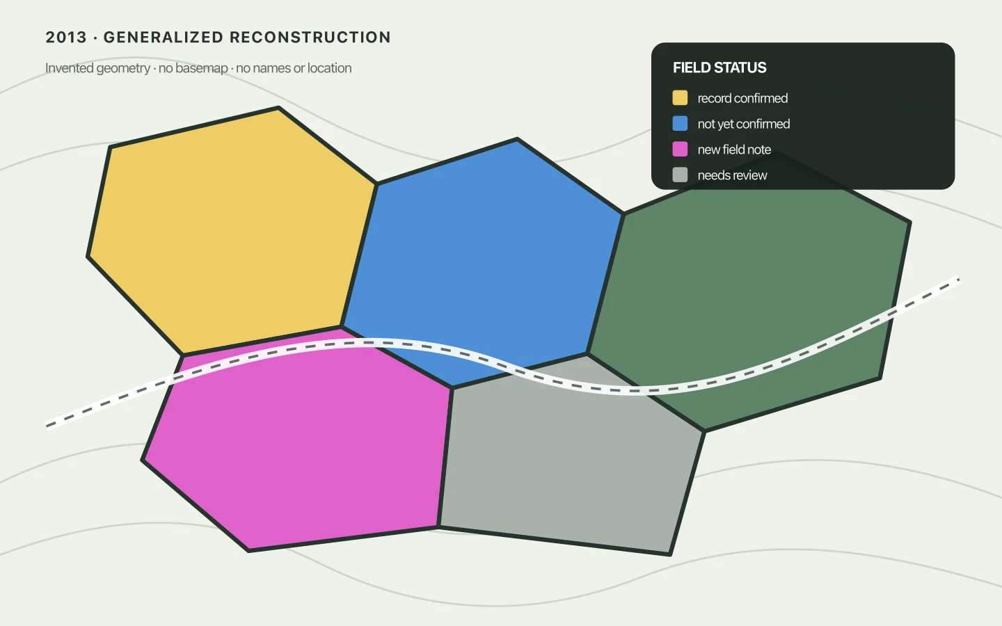
Public-safe reconstruction Invented geometry; no basemap, names, areas, or client location.
ArcMap 10.1 · Forestry operations
Field status, made legible
Problem
A forestry job held areas in several paperwork states. The map needed to distinguish confirmed, new, and unresolved information without pretending uncertain records were settled.
Inputs
Working GIS layers, property-reference information, previous mail-outs, and field notes that still needed checking.
Method
Revised colour categories in ArcMap and carried uncertainty into the legend instead of smoothing it away.
Output
A field and office reference map with a deliberately visible “needs review” state.
It supported: reconciling the map and paperwork before follow-up.
It did not establish: survey boundaries, title, Crown status, or present-day conditions.
2015
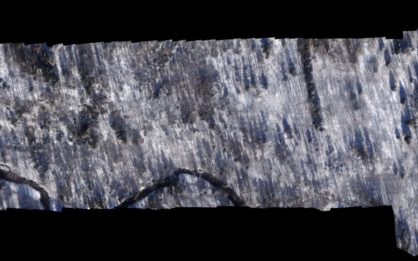
Creator-captured imagery Tight crop from the original mosaic; structures and location context removed.
Field capture · Raster stitching
A first aerial mosaic
Problem
See a whole flown area rather than a folder of disconnected frames.
Inputs
Camera images captured by Dan during a flight over the work area.
Method
Stitched overlapping frames into one continuous, zoomable PDF while keeping the imperfect first-pass seams visible.
Output
A continuous winter mosaic that made terrain and image coverage easier to review.
It supported: reviewing coverage, stitch quality, and broad terrain relationships.
It did not establish: survey-grade position, orthophoto accuracy, or current conditions.
2023
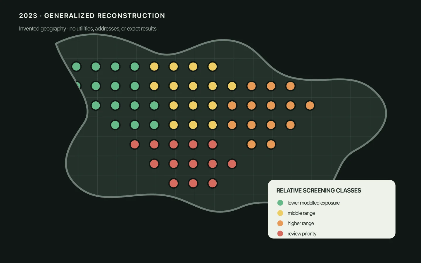
Public-safe reconstruction Invented geography and classes; utilities, addresses, basemap, and exact results removed.
QGIS 3.30 · Scripted spatial analysis
A regional question, screened spatially
Problem
Compare where a hypothetical 200-metre turbine might be visible from fewer or more buildings across a large candidate area.
Inputs
A regular candidate-point grid, land-screening geometry, and modelled building-visibility counts.
Method
QGIS plus an adjustable scripted analysis developed iteratively from the plain-language question.
Output
A classified regional screening map that made relative patterns visible.
It supported: comparing parameters and focusing further research.
It did not establish: wind resource, siting approval, grid access, land rights, environmental suitability, or project viability.
2023
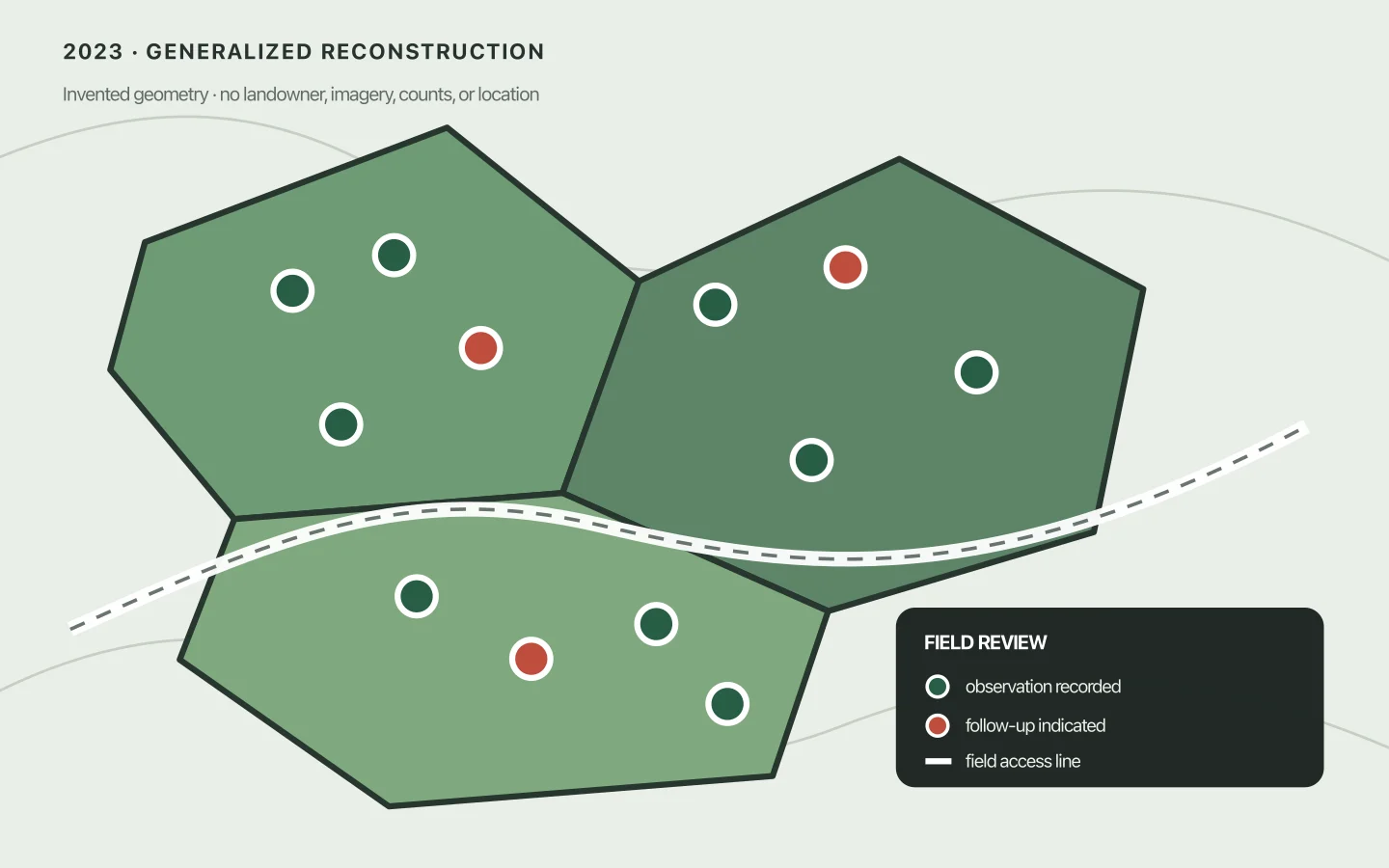
Public-safe reconstruction Invented treatment blocks and sample points; landowner, counts, outcome, imagery, and location removed.
QGIS 3.32 · Field verification
Field observations, returned as a decision map
Problem
Turn a planting inspection and its tally into a clear account of what was observed and where follow-up might be needed.
Inputs
Field plot observations, tree-condition counts, photographs, and a treatment boundary.
Method
Reviewed how the tally should be interpreted, connected observations back to the map, and kept the field evidence alongside the summary.
Output
A plot map and companion tally for review and follow-up.
It supported: reviewing a historical, sample-based field outcome and locating areas to revisit.
It did not establish: a whole-site inventory, a current condition, or a result independent of the agreed tally method.
2026
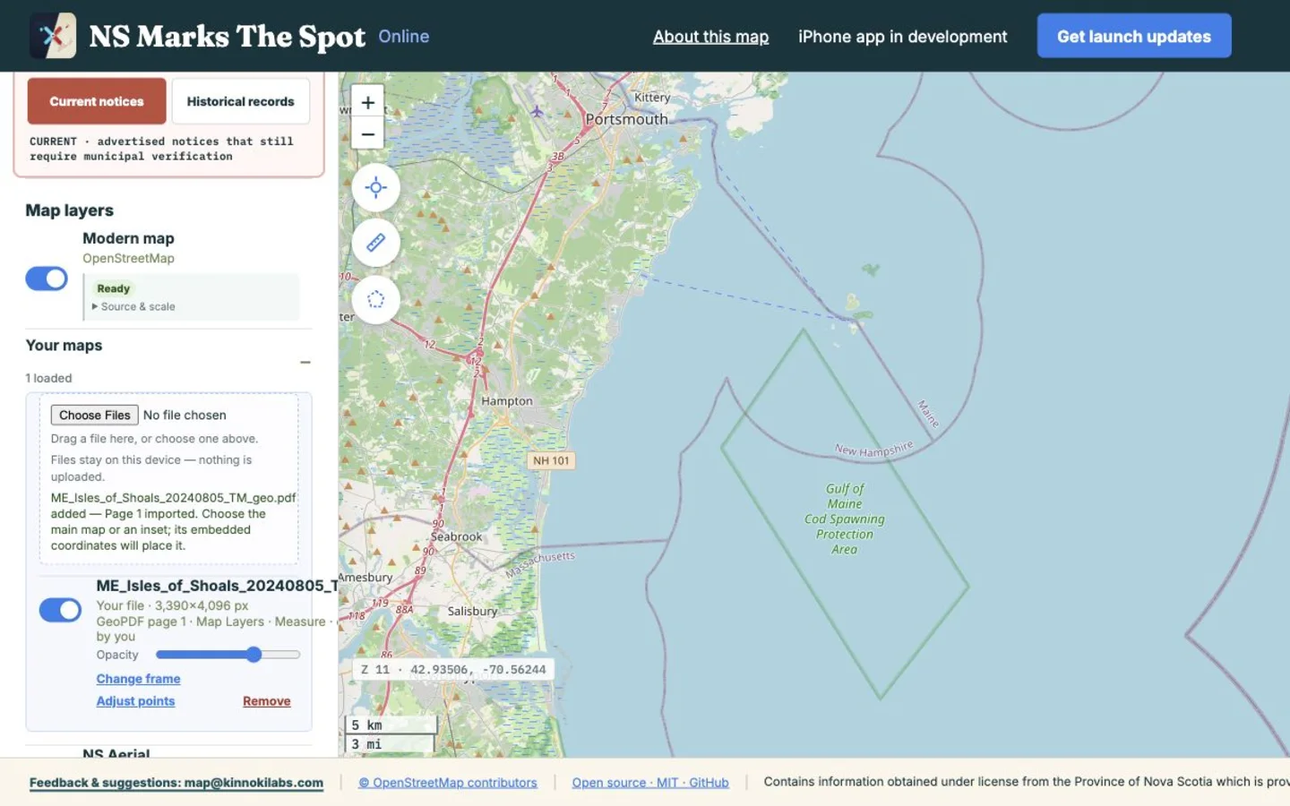
Product acceptance capture Local import UI over OpenStreetMap; imported GeoPDF content is not displayed.
Native + browser mapping · Product engineering
The map became a product
Problem
Historical scans, public records, and field position arrive in different formats — often with weak connectivity, privacy constraints, and source-specific licence terms.
Inputs
Official and public sources, user-owned images and GeoPDFs, and the local context a researcher brings to the map.
Method
Offline-first native tiles; browser georeferencing with embedded GeoPDF frames or manual control points; local-file handling, source receipts, and licence gates.